
Vertical Ces
- Distance: 2,2 km
- Difference in height: 550 m
- Maximum altitude: 2230 m a.s.l.
- Time for hikers: 1h45m
- Time for runners: 1h
- Road surface: Trail
- Difficulties: Medium
[to download the GPX track, right-click here and select “Save As…”]
Trail Description
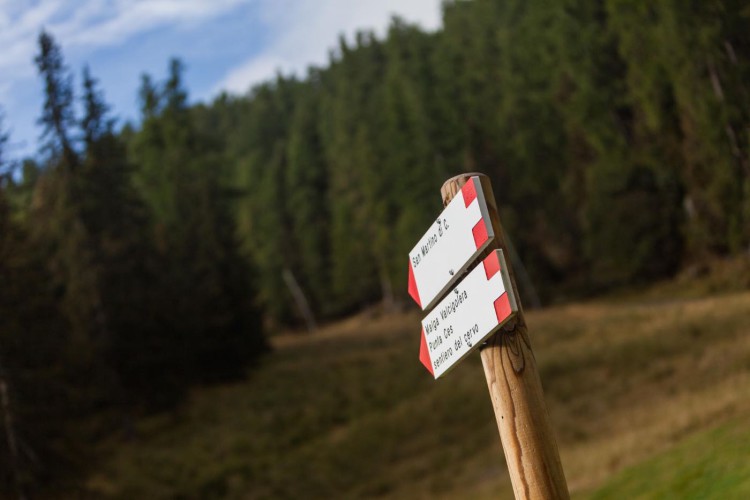
From the Caserota, the little wooden chalet of Malga Ces, follow the indications to Punta Ces – Sentiero del Cielo which leads straight to Malga Ces, a route which offers beautiful views on the Pale di San Martino.
Interesting Aspects
This amazing steep route is the ideal trail for the vertical route (tracks which permits to reach high altitude in a very short time) enthusiasts. Punta Ces, located on an altitude of 2227 meters constitutes a sort of balcony on the Dolomites: its position permits to enjoy unique landscapes, to admire the entire mountain range of the Pale di San Martino, and to glimpse in the distance the massif of the Marmolada.