
Giro della Pace
- Distance: 3,7 km
- Difference in height: 300 m
- Maximum altitude: 1900 m a.s.l.
- Time for hikers: 2h
- Time for runners: 1h20m
- Road surface: Trail
- Difficulties: Easy
[To download the GPX track, right-click here and select “Save As…”]
Trail Description
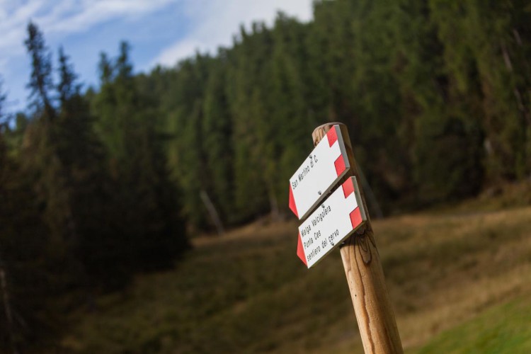
From the Caserota, the little wooden chalet of Malga Ces, get to San Martino di Castrozza on a beautiful path through the forest. Enter the wood and then follow the Malga Valcigolera-Sentiero del Cervo trail: this path rises to the crest which divides two valleys, the Valbonetta and the Valcigolera. In its final section, the path follows the crest and offers in tis higher point the most amazing landscape of San Martino di Castrozza.
Get to the Rekord slope, and from here, follow the signs to Malga Ces-Sentiero della Pace which is located on the edge of the slope. Follow the very easy trail which leads to Pian delle Cartucce, but before getting to the flatland, take the path Sentiero del Cielo, and then walk back to Malga Ces.
Interesting Aspects
The trail goes thorugh some woods, some bright larch woods where it is frequent to see grazing deers (for this reason, a very near path is named after these beautiful animals). The recently repaired Sentiero della Pace path is, on this section, like a balcony on the Pale di San Martino. This trail is part of a 521 km way which from Tonale Pass to the Marmolada connects memories and spots of the first World War.