
Malga Cigolera
- Distance: 7 km
- Difference in height: 390 m
- Maximum altitude: 1881 m a.s.l.
- Time for hikers: 2h30m - 3h
- Time for runners: 1h20m
- Road surface: Trail
- Difficulties: Easy
[To download the GPX track, right-click here and select “Save As…”]
Trail Description
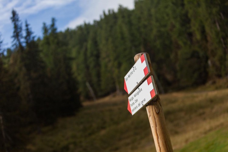
From the Caserota, the little wooden chalet of Malga Ces, get to San Martino di Castrozza on a beautiful path through the forest; on the Valcigolera path, follow the indications to San Martino until the crossroads. Here, turn right and walk along the forestry road to the Rio Cigolera bridge. After the bridge, turn right again and walk along the road which will become more steep, to reach the beautiful hut of Malga Cigolera and have a break. To come back, follow the indications and walk on the crest between the two valleys, follow the Sentiero del Cervo (the deer path) and then get to Malga Ces.
Interesting Aspects
The path goes first thorugh the spruce fir woods, and then through larch forests in the higher section of the trail, just in proximity to the meadows around the hut. Before the bridge on Rio Cigolera, as an alternative to the forestry road, it is possible to take the Heidi path, recently repaired, which leads to Malga Valcigolera hut and permits to shorten the trail, but definitely more suggestive in terms of landscape and natural environment.